Upper Plain Road
Some streets end up having a multiplicity of names. At various times their informal names change, and developers try to force more ‘up-market’ names onto perfectly serviceable common names. Upper Plain Road is one such street.
The name is self-explanatory. It is the road to the upper plain, the area known to Maori as Kohangawareware. Over the years various attempts have been made to impose more impressive sounding names on this stretch of road.
The Wairarapa North County Council records sometimes called it the Fernridge Road or the Kaituna Road. Richard Kibblewhite, in the map he produced to promote his subdivision of land in Kibblewhite Road and the surrounding areas in 1878, called it Broadway Avenue.
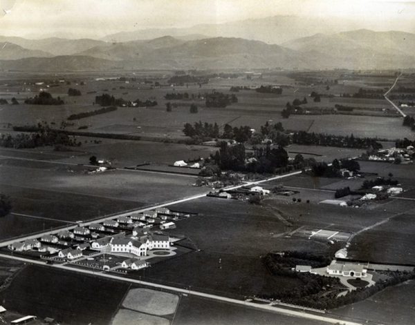
Later still, after the Whatman houses were constructed near the Ngaumutawa Road corner, it was proposed to call the road either Soldiers Settlement Road or Panama Terrace, Panama being the name of A.P. Whatman’s house.
The whole matter became more confused as the Borough and County boundary in this area moved on a number of occasions. At one time the boundary specifically ran up Upper Plain Road to encircle the Whatman houses, whose postal address was then Renall Street.
When the Borough boundary extended out to Kibblewhite Road the numbering system for houses in Upper Plain was out of kilter, and by 1970 needed correcting. The houses on the north side of the street had been numbered as an extension of Renall Street, while those on the south were numbered as Upper Plain Road, with numbers starting at Ngaumutawa Road. In 1970 the Borough Council declared the street to be Upper Plain Road (which, legally it always was) and numbered the street accordingly, houses on the northern side of the street losing about 150 off their street numbers.
Pic: Upper Plain Road, showing the Whatman houses near the junction of Ngaumutawa Road.
Short Street
One of the mysteries in the naming of Masterton streets concerns Short Street – and it involves irony as well. The street is now literally a short street, as it runs from Harley Street to High Street, it being given this name when the long street, called Short Street, was broken into three streets, namely Hillcrest, Intermediate and Short Streets.
When Short Street was first constructed it did not include the piece now called Short Street. It ran from High Street across to a junction with York Street, then took a sharp turn up to the upper plain, where it joined the road which became known as Ngaumutawa Road.
It was a problem street for the council in the late 1870s and there are frequent notes in the minutes talking of the slowness of construction, of the trouble removing stumps, and the encroachment of some of the sections into the carriageway. The street is sometimes held to have been named facetiously. It is claimed that the mile long street was named in the time-honoured manner in which red headed men are called “Blue”.
It seems, however, more likely that the street was named in honour of Elijah Short, an early settler from the area.
For many years the street was known as the Kuripuni Railway Road, as it later lead to the Kuripuni Railway Station, now known as the Solway Station.
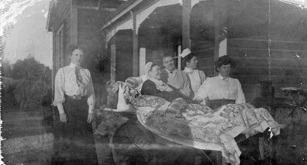
Pic: Augustus and Polly Cave's house 'Nympsfield' was in the short part of Short Street.
Hillcrest Street and Intermediate Street
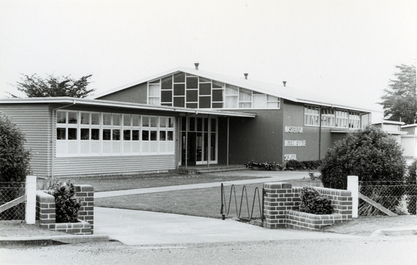
Short Street was divided into three when the reconstruction of the York Street/Short Street corner took place. Hillcrest Street was for the geographical feature that dominates the contour of the street, and Intermediate Street took its name from the Masterton Intermediate School, sited in the street. These names were given after a competition held among the pupils of the school during the 1970s.
Pic: Masterton Intermediate School gave its name to a street.
South Belt
It is also ironical that the town which once had two streets named Junction should now have none.
The small stretch of road from Villa Street to the railway station was known as Junction Street. In 1905 Perry, Pine and Junction Streets were all joined into the one – Perry Street.
Junction Road was changed at the same time. Junction Road ran from High Street across to the end of South Road, changing into Manaia Road as it headed further east. In 1905 this name was also changed and the street became known as South Belt.
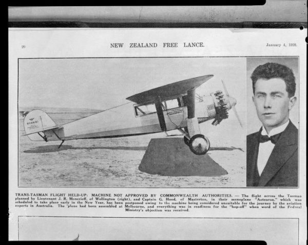
Much later one resident of the street, complaining that his mail ended up in South Road, suggested that the street should be renamed to avoid any confusion. He further suggested that it should be called Moncreiff Road to honour George Hood’s co-pilot. The suggestion was not accepted.
Pic: Some have suggested South Belt should be renamed to honor John Moncrieff.
Park Street, Park Avenue and Memorial Drive
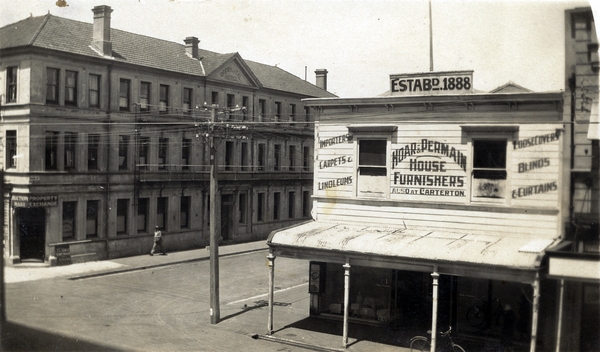
Queen Elizabeth Park, once known as Masterton Park, has also given its name to a number of streets. The first of these, Park Avenue, which runs along the southern boundary of the park, was so named because the Masterton Park Trustees gave the land for the street to the Borough Council.
The confusingly named Park Street started out its life as Cross Street, probably because it formed a cross with Cricket Street, although it may have simply been because it is a cross street from Dixon to Queen Street. It is certainly well named, as it leads directly to the Pownall Gates entrance to the park.
The road around the park lake was officially named Memorial Drive after World War Two. At the same time the lake, which was extended, was given the name of the Lake of Remembrance.
Pic: The corner of Queen and Park streets.
Villa Street
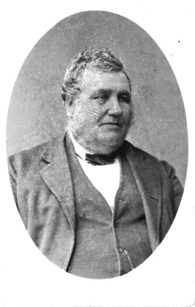
Villa Street was to be called Bannister Street at first. The name was changed when the road in the centre of town was called Bannister Street. The man it was named after, Henry Bannister, was a member of the Masterton Borough Council at the time, and had been living in the southern end of Villa Street for a period.
The new name was given because there was an attractive villa, perhaps Bannister’s, in the street.
Pic: Henry Bannister's house is said to have given its name to Villa Street.
River Road and College Street
Some given names are strictly utilitarian. River Road, one of Masterton’s oldest roads, was named because it led down to the river, or rivers to be exact as it leads to the confluence of the Waipoua and Ruamahanga Rivers. In the 1880s a wool scour was situated at the river end of the road.
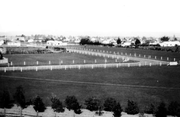
College Street was similarly named. It was laid out in 1926, some three years after the establishment of the High School in Pownall Street. The developer, Walter Nops, named this after the street he lived in as a child in England and placed concrete milestones at each end of the street, to replicate those from his home town.
Pic: College Street as seen from oil tanks in Ngaumutawa Road in the 1930s.
Harlequin Street and Masonic Street
Some streets are named to reflect buildings that are in the neighbourhood. Harlequin Street was so named because of the proximity of the Harlequin theatre. When the street was named in 1968 there was discussion of the original proposal to call the street Eagle Street as it ran through the grounds of the old Eagle Brewery.
Some local residents state that the road was constructed over the site of an old burial ground, three children being buried in the area.
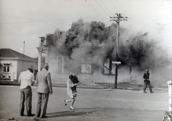
Masonic Street took its name from the Masonic Hall that stood on the corner of Masonic and Bannister Streets. The hall, which was used by the Orange Lodge when the Masons built their hall in Chapel Street, burned down in the 1960s. The replacement Orange Hall is now used as a church.
Pic: The Masonic Hall on fire in 1964.
Solstone Drive
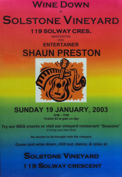
Solstone Drive is a small street off Solway Crescent, and takes its name from the nearby winery. Solstone Winery was a portmanteau word, combining the name location Solway with the physical nature of the soils along the banks of the Waingawa River – stony. One of Masterton’s first vineyards, established in the 1890s in the nearby Solway Street area, was called the Tararua Vineyard.
Pic: Solstone Vineyards held 'Win
Waipoua Drive
Waipoua Drive has a euphonious ring as a street name. It was at one time proposed to call the post-war extension of Villa Street to Chapel Street by this name, but the proposal fell through, Villa Street being retained. The road between the two bridges in Queen Street, roughly from the stadium to the current course of the river, was once called Waipoua Road or Lansdowne Road, although it is now part of Queen Street.
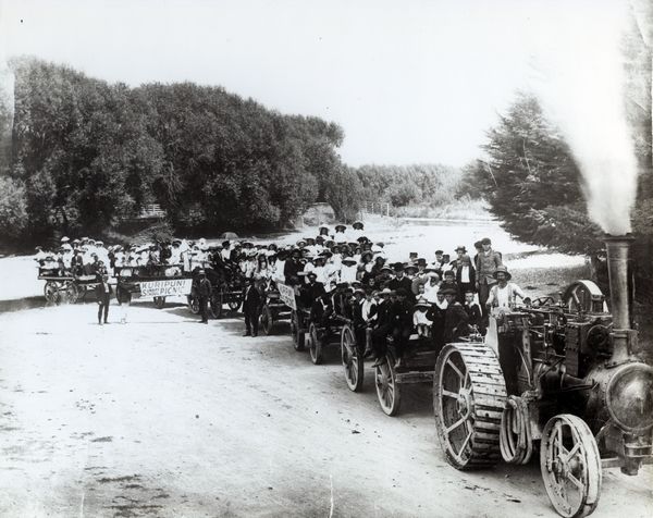
Pic: In the early 1900s, the Kuripuni Methodist Sunday School formed their own Waipoua Drive by trekking through the river with traction engines.


