Some streets end up having a multiplicity of names. At various times their informal names change, and developers try to force more ‘up-market’ names onto perfectly serviceable common names. Upper Plain Road is one such street.
The name is self-explanatory. It is the road to the upper plain, the area known to Maori as Kohangawareware. Over the years various attempts have been made to impose more impressive sounding names on this stretch of road.
The Wairarapa North County Council records sometimes called it the Fernridge Road or the Kaituna Road. Richard Kibblewhite, in the map he produced to promote his subdivision of land in Kibblewhite Road and the surrounding areas in 1878, called it Broadway Avenue.
Later still, after the Whatman houses were constructed near the Ngaumutawa Road corner, it was proposed to call the road either Soldiers Settlement Road or Panama Terrace, Panama being the name of A.P. Whatman’s house.
The whole matter became more confused as the Borough and County boundary in this area moved on a number of occasions. At one time the boundary specifically ran up Upper Plain Road to encircle the Whatman houses, whose postal address was then Renall Street.
When the Borough boundary extended out to Kibblewhite Road the numbering system for houses in Upper Plain was out of kilter, and by 1970 needed correcting. The houses on the north side of the street had been numbered as an extension of Renall Street, while those on the south were numbered as Upper Plain Road, with numbers starting at Ngaumutawa Road. In 1970 the Borough Council declared the street to be Upper Plain Road (which, legally it always was) and numbered the street accordingly, houses on the northern side of the street losing about 150 off their street numbers.
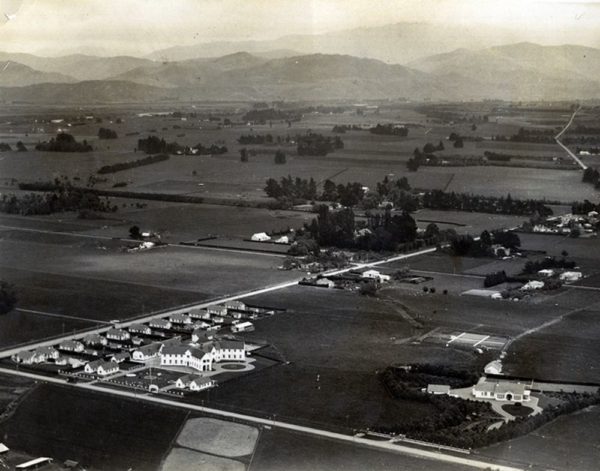
Pic: Upper Plain Road, showing the Whatman houses near the junction of Ngaumutawa Road.